An Andaman Islands earthquake of magnitude 5.4 struck the Andaman Sea on Sunday, shaking structures in the Andaman and Nicobar Islands with no reported damage. The National Centre for Seismology recorded the event at 12:06 pm IST, centred 126 km southeast of Diglipur at a depth of 90 km. Authorities issued no tsunami alerts. Residents felt mild tremors. This incident highlights the ongoing seismic activity in the Andaman Sea in November, a trend characteristic of a tectonically active zone.
The Andaman Islands earthquake highlights South Asia’s vulnerability to seismic events along the Indo-Australian plate boundary, where similar quakes pose a threat to coastal communities from India to Indonesia. With over 500 tremors annually in the region, it prompts renewed focus on disaster preparedness amid rising tourism and fishing activities.
India Andaman Quake Magnitude 6.0 Sparks Data Discrepancy
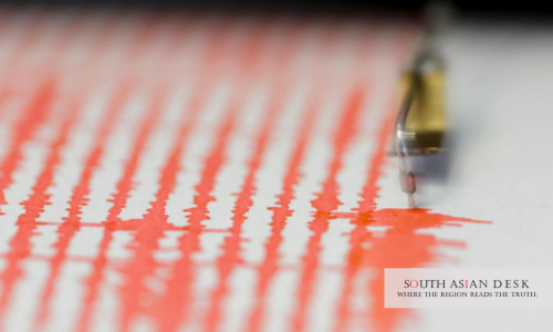
The National Centre for Seismology pegged the magnitude of the India Andaman quake at 6.0 on the Richter scale, but it was recorded as 5.4. Its epicentre lay at latitude 12.49 N and longitude 93.83 E in the Andaman Sea. Depth measured 90 km, classifying it as an intermediate event unlikely to cause surface rupture.
The German Research Centre for Geosciences reported a magnitude of 6.07, a common variance in preliminary assessments. NCS reviewed its data swiftly, confirming the lower figure based on local seismic networks. The quake lasted for seconds, with an intensity of IV on the Modified Mercalli scale in Diglipur.
Local officials in Port Blair noted that the Andaman Islands earthquake was registered on instruments but caused no structural damage. Fishermen offshore reported boat rocking. The administration activated monitoring protocols in accordance with the guidelines of the National Disaster Management Authority.
No Tsunami After Andaman Earthquake Eases Fears
The Indian National Centre for Ocean Information Services detected no tsunami threat following the earthquake in the Andaman Islands. Depth and magnitude fell below thresholds for wave generation. INCOIS issued no bulletins, aligning with standard protocols for events with a magnitude of 7.0 or less at a depth of 90 km.
Historical precedents reinforce this outcome. The 2004 Sumatra-Andaman quake, with a magnitude of 9.1, generated devastating waves due to its shallow rupture. Sunday’s event posed minimal risk. Authorities advised coastal vigilance regardless. No evacuations occurred.
Residents in the Nicobar districts felt aftershocks up to 3.4 magnitude later that day. NCS tracked these as normal. The absence of alerts allowed normalcy to resume quickly.
Andaman Sea Seismic Activity November Intensifies Monitoring
Seismic activity in the Andaman Sea surged in November, following the Andaman Islands earthquake, which was part of a cluster that included a 4.3 event on October 25. The Sunda Trench exhibits such a high frequency, where the Indian plate subducts under Burma. Over 20 quakes above 4.0 have hit the arc since September.
NCS data logs 126 km separation from Diglipur, sparing populated areas. Port Blair, 250 km southwest, experienced light shaking. Hotels reported guest inquiries, but there was no panic.
Experts attribute the November upticks to the monsoon withdrawal, which eases atmospheric pressure on faults. The Indian Meteorological Department correlates this with the release of dry-season stress. Regional networks, including Thai and Indonesian stations, corroborated timings.
South Asian nations jointly monitor developments via the BIMSTEC forums. Pakistan’s seismic bureau noted distant vibrations in Balochistan, though imperceptible.
Background
The Andaman and Nicobar Islands chain sits atop a volatile geological region. Formed by subduction, it hosts the only active volcano in India, namely Barren Island. Since 1900, over 100 quakes above 6.0 struck nearby, per USGS archives. The 1941 event, with a magnitude of 7.7, triggered minor tsunamis.
Post-2004 reforms bolstered warnings. INCOIS, established in 2007, integrates satellite buoy data. NDMA conducts annual drills, including a recent November 4 mock drill in the Andamans, simulating an 8.0 earthquake.
Tourism booms expose risks. Over 500,000 visitors annually flock to Havelock beaches. Insurers now mandate quake coverage. Fishing fleets, vital to the livelihoods of 100,000 people, are equipped with alerts via the BhooKamp app, promoted by NCS.
Cross-border ties matter. Myanmar shares the arc, with 2023 quakes displacing thousands: Bangladesh and Sri Lanka eye Indian data for Bay of Bengal safety.
What’s Next
NCS plans aftershock analysis through November. INCOIS will review thresholds if clusters persist. Local drills resume in December. Enhanced sensors are expected to arrive in 2026, under an allocation of INR 500 million (approximately USD 6 million). Regional summits at SAARC push shared early warning.
The Andaman Islands earthquake serves as a reminder. Preparedness turns potential tragedy into routine. Islands breathe easier today, but vigilance endures.
Published in SouthAsianDesk, November 10th, 2025
Follow SouthAsianDesk on X, Instagram, and Facebook for insights on business and current affairs from across South Asia.