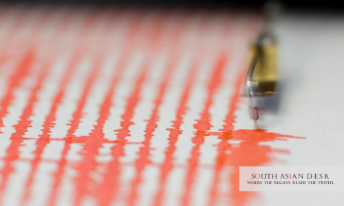
Japan’s issuance of a megaquake advisory on December 10 has spotlighted the Great Himalayan Earthquake threat, prompting India to reassess risks along its northern borders. The Japan Meteorological Agency triggered the alert after a magnitude 7.5 tremor struck off Aomori Prefecture on December 8, warning of a possible magnitude 8-plus event with one per cent odds. This event, occurring on the Pacific Ring of Fire, mirrors stresses building under the Himalayas, where the Indian plate collides with the Eurasian plate at 5 cm annually.
The advisory, the first top-tier alert since 2022, covers regions from Hokkaido to Chiba. Cabinet disaster prevention official Tsukasa Morikubo clarified during a December 10 briefing: “The latest advisory has no prediction for any megaquake happening at any specific time or location.” Yet, projections outline stark impacts: up to 300,000 deaths and economic damage halving Japan’s GDP. In India, this Japan megaquake warning India has ignited debates on parallel vulnerabilities, as the Great Himalayan Earthquake looms over 75 per cent of the population exposed to seismic hazards.
Japan Megaquake Warning India Echoes Himalayan Fears
Japan’s alert stems from the Nankai Trough’s potential rupture, a subduction zone akin to the Main Himalayan Thrust. That fault line, locked for centuries, accumulates strain capable of unleashing a magnitude 8 or greater quake. The December 8 event caused 34 injuries, road cracks and a brief tsunami, but officials activated evacuation checks and relief stock reviews until December 16.
Indian seismologists draw direct links. The National Centre for Seismology (NCS), under the Ministry of Earth Sciences, monitors similar dynamics. Director Dr Om Prakash Mishra noted in a recent assessment: “At the moment, it seems the Himalayas are protecting us as it is slowly releasing the stress building deep within the planet by small-sized quakes from time to time. These are M2.5-3.5 quakes that don’t do much damage but largely release the overbuilt stress within the fractures and the tectonic plates. So, at the moment, we need not worry about the Great Himalayan Earthquake.”
This aseismic creep acts as a buffer, but experts caution it masks deeper pressures. The central Himalayan segment, silent since the 1505 event, holds enough energy for a rupture spanning 400 km. Such a Great Himalayan Earthquake could strike Delhi, affecting 30 million residents within 200 km, and cascade into Nepal and Bhutan.
South Asia bears acute stakes. The region hosts 1.9 billion people, with the Indo-Gangetic plains amplifying shake intensities through soft sediments. Nepal’s 2015 magnitude 7.8 quake killed 9,000 and displaced millions; a larger event could multiply those tolls across borders. India’s shared 1,700 km frontier with Nepal places Uttar Pradesh and Bihar in the crosshairs, where fragile dams and highways risk collapse.
Himalayan Earthquake Risk Rises with Zone VI Upgrade
India’s Bureau of Indian Standards (BIS) unveiled a revised seismic zonation map in November 2025, classifying the entire Himalayan arc as Zone VI – the highest hazard level. This update, part of the Earthquake Design Code 2025, expands moderate-to-high risk coverage to 61 per cent of landmass, up from 59 per cent.
Previously split into Zones IV and V, the arc now unifies under Zone VI, encompassing Jammu and Kashmir, Ladakh, Himachal Pradesh, Uttarakhand, Sikkim and Arunachal Pradesh. The map employs probabilistic seismic hazard assessment, factoring active faults, maximum probable magnitudes and ground attenuation. It introduces an “exposure window” via probabilistic exposure and multi-hazard methodology, weighing population density and infrastructure vulnerability.
BIS mandates adoption for all new builds, enforcing stricter norms for critical sites like hospitals and bridges. These must function post-quake, incorporating liquefaction checks and site-specific spectra. Secretary, Ministry of Earth Sciences, Dr M Ravichandran, highlighted during the December 5 inauguration of the Bharat Earthquake Early Warning Data Receiving Centre: the need for “innovation-driven systems, advanced technologies, and real-time data in building stronger disaster resilience.” He stressed global ties, including with Taiwan’s NCDR, for data sharing.
The map flags 75 per cent population exposure, urging retrofits in urban hubs like Dehradun and Shimla. Ground accelerations in Zone VI could hit 0.36g, demanding ductile designs and non-structural safeguards for ceilings and facades.
India Earthquake Preparedness Gains Momentum
Authorities ramp up measures amid the Himalayan earthquake risk. The National Disaster Management Authority (NDMA) conducted a statewide mock drill on November 17 in Sikkim, simulating multi-hazard scenarios with army, air force and border units. NDMA’s pavilion at the India International Trade Fair 2025 featured earthquake simulations, drawing praise for hands-on training.
The Sachet app delivers instant alerts, vital for remote Himalayan districts. NCS reports 4.2 magnitude tremors near Nepal on December 9, underscoring constant vigilance. Early warning systems, now linked internationally, aim for 30-second leads – enough for “drop, cover, hold.”
Budget allocations under the National Disaster Management Plan 2025 prioritise resilient infrastructure. Rs 10,000 crore funds seismic upgrades in schools and hospitals. Community drills emphasise evacuation routes and family kits, targeting 80 per cent coverage by 2027.
Yet gaps persist. Rural areas lag in retrofitting, and enforcement varies. The December Japan megaquake warning India serves as a stark reminder: preparedness saves lives.
Background: A History of Himalayan Tremors
The Himalayas’ volatility traces to plate convergence, birthing quakes every 500-700 years per segment. The 1934 Bihar-Nepal magnitude 8.0 event levelled structures across 300 km, claiming 10,000 lives. The 1905 Kangra quake magnitude 7.8 killed 20,000 in Punjab hills.
Post-2015 Nepal disaster, India bolstered monitoring with 150 stations. The Great Himalayan Earthquake remains elusive, but strain gauges show 6 metres slip deficit since 1505 – equivalent to a magnitude 8.5 release.
What’s Next for the Great Himalayan Earthquake
Enhanced radar networks and AI-driven forecasts headline 2026 plans. MoES eyes expanded collaboration with Japan and USGS for thrust fault modelling. Public campaigns will push annual drills, while BIS audits ensure code compliance. As tectonic plates grind, India’s focus sharpens on turning warnings into action, shielding South Asia from the next seismic surge.
Published in SouthAsianDesk, December 11th, 2025
Follow SouthAsianDesk on X, Instagram, and Facebook for insights on business and current affairs from across South Asia.