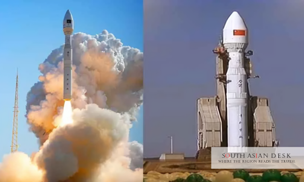
Pakistan launched its first hyperspectral satellite, HS-1, from China’s Jiuquan Satellite Launch Centre on Sunday, October 19, 2025. The mission, led by SUPARCO, aims to deliver high-resolution data for agriculture, environment, urban planning and disaster response, in collaboration with Chinese partners.
This launch elevates Pakistan’s role in space technology within South Asia. Amid rising climate threats like floods and deforestation, the SUPARCO hyperspectral satellite offers tools for better regional cooperation on environmental issues and sustainable development.
Pakistan HS-1 Satellite Launch Details
The Pakistan HS-1 satellite launch occurred at the Jiuquan facility in northwestern China. SUPARCO confirmed the satellite entered orbit successfully. In-orbit testing will last up to two months before full operations begin this year.
The mission builds on Pakistan’s recent space activities. Earlier in 2025, SUPARCO deployed EO-1 in January and KS-1 in July, both now operational. HS-1 joins PRSS-1, launched in 2018, expanding the remote-sensing fleet. Project Director Mushtaque Hussain Soomro called the launch a leap in Pakistan’s space roadmap. It positions the country as an emerging leader in sustainable space tech.
SUPARCO Hyperspectral Satellite Capabilities
HS-1 features advanced hyperspectral imaging across hundreds of narrow spectral bands. This allows detection of subtle changes in soil, vegetation, water and materials that standard satellites miss.
In precision agriculture, the SUPARCO hyperspectral satellite will map crop health, soil moisture and irrigation. Data could improve yield estimates by 15-20 per cent, supporting food security in a nation where farming employs over 40 per cent of the workforce. For environmental monitoring, HS-1 tracks deforestation, pollution and glacial melt in northern areas. It aids geo-hazard assessment along key routes like the Karakoram Highway.
Urban planning benefits from infrastructure mapping and growth analysis. The satellite captures spectral signatures of man-made structures for efficient land use. In disaster management, HS-1 enhances early warnings for floods and landslides. It supports post-event assessments and transportation analysis.
Background
Pakistan’s space programme dates to 1961 with SUPARCO’s founding. Early efforts focused on upper atmosphere research. The 2011 National Space Policy aimed at self-reliance in satellite tech.
Collaboration with China has been key. The China-Pakistan Economic Corridor integrates space applications for infrastructure safety. Pakistan launches hyperspectral satellite missions like HS-1 reflect this partnership for peaceful exploration. SUPARCO’s Vision 2047 seeks to advance innovation for national growth. HS-1 aligns with this, following remote-sensing successes. Technical details on HS-1’s orbit or resolution remain limited.
What’s Next
Calibration and testing follow the Pakistan HS-1 satellite launch. Once operational, data will integrate into national systems for agriculture and disasters. Future plans include more satellites under Vision 2047. This could foster South Asian collaborations on climate data sharing. Pakistan launches hyperspectral satellite initiatives like HS-1 signal a commitment to tech-driven progress, with potential impacts on regional stability and development.
Published in SouthAsianDesk, October 20th, 2025
Follow SouthAsianDesk on X, Instagram, and Facebook for insights on business and current affairs from across South Asia.


