From the ground, a border can seem permanent. It may be marked by fences, checkpoints, watchtowers and maps. It can carry the weight of wars, treaties, memories and political disagreements. But from several hundred kilometres above the Earth, those lines begin to lose their certainty.
A river does not stop because a border has been drawn across it. A cyclone does not change direction because it has entered another country. A glacier does not recognise the political divisions of the mountains where it was formed.
From space, South Asia looks less like a collection of separate countries and more like a network of connected systems.
That difference in perspective may matter more than we realise.
South Asia is already living with environmental problems that are difficult to contain within national boundaries. Floods move through river basins. Cyclones travel across the Bay of Bengal. Monsoon systems affect several countries at once. Changes in the Himalayas have consequences far beyond the mountains themselves. The World Bank estimates that almost 750 million people in South Asia were affected by at least one climate-related disaster during the past two decades. It also notes that weather and climate hazards do not respect national borders, making regional cooperation increasingly important.
This is where space technology enters a conversation that is usually dominated by rockets, astronauts and ambitious missions.
Satellites are often imagined as instruments that take humanity farther away from Earth. Yet some of their most important work is happening in the opposite direction. They help us understand what is happening on Earth: where floodwaters are spreading, how cyclones are moving, how drought is developing, how coastlines are changing and how vulnerable landscapes are responding to extreme weather.
India’s space programme already uses satellite-based information for disaster management, including the monitoring of floods, cyclones, droughts, landslides and other hazards. ISRO’s Disaster Management Support Programme provides satellite-derived information to authorities before, during and after major disasters. Its systems are also connected to international disaster-management frameworks, showing that the value of satellite information does not necessarily end at a country’s borders.
The technology, therefore, is already here.
The more difficult question is what we choose to do with it.
If satellites can show countries the same cyclone, the same flood system or the same environmental change, could that shared view become a new basis for regional cooperation?
Not peace in the grand, romantic sense.
Not the idea that a satellite can somehow solve decades of political disagreement.
Something smaller, but perhaps more practical: a reason to keep talking.
LOOKING AT THE SAME PROBLEM
Consider a flood.
On a political map, it belongs to a particular country. On an environmental map, the picture is different. Rivers cross territories, rainfall moves across regions and water systems connect communities that may live on opposite sides of an international boundary.
The Ganga-Brahmaputra-Meghna system is an obvious example of this interconnectedness. Decisions made upstream can have consequences downstream, while extreme rainfall, river discharge and flooding can affect several countries within the same ecological system.
The same principle applies to the Bay of Bengal. A cyclone does not become an exclusively national event simply because it crosses into another country’s waters. Its development, movement and consequences are part of a larger atmospheric and oceanic system.
This is where Earth observation becomes particularly valuable.
ISRO lists applications of satellite-based Earth observation across agriculture, water resources, ocean studies, monitoring of glacial lakes and water bodies, extreme weather and disaster management. Satellite information can therefore provide governments with a wider picture of environmental conditions than what can be observed from the ground alone.
But seeing a shared problem is only the beginning. The information has to move. And that is where diplomacy enters the picture.
THE SATELLITE THAT WAS SUPPOSED TO CONNECT A REGION
South Asia has already experienced an important experiment in this regard.
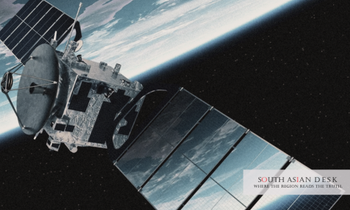
In May 2017, India launched GSAT-9, popularly known as the South Asia Satellite. The geostationary communication satellite was designed to provide communication services across South Asian countries. Its proposed applications included telecommunications, broadcasting, disaster-management support, meteorological data transmission, education and other development-related services.
The project was significant not simply because India had launched another satellite, but because the satellite was presented as a regional resource.
At the time of its launch, participating countries included Afghanistan, Bangladesh, Bhutan, India, Maldives, Nepal and Sri Lanka. Pakistan did not join the project. The absence itself illustrated an uncomfortable reality: technological cooperation cannot be separated completely from political relationships.
That is an important lesson for any discussion about space diplomacy in South Asia.
It would be easy to tell the story as a simple success: countries sharing technology, borders becoming less important and space creating a new era of friendship.
Reality is less tidy.
Technology can create opportunities for cooperation, but governments still decide whether those opportunities are acceptable. Questions of sovereignty, strategic interests, technological dependence and political trust remain.
A satellite can connect countries.
It cannot make them agree.
Yet perhaps agreement is not always the starting point.
THE QUIETER DIPLOMACY OF WEATHER
One of the most interesting examples of regional cooperation is not found in a launch centre at all. It is found in the work of meteorologists and hydrologists.
The South Asia Hydromet Forum, supported by the World Bank, brings together meteorological and hydrological professionals from Afghanistan, Bangladesh, Bhutan, India, Maldives, Myanmar, Nepal, Pakistan and Sri Lanka. Its work includes technical training, knowledge exchange, data sharing and cooperation on forecasting and early-warning systems.
Since 2022, forecasters from across the region have also met virtually on a regular basis to discuss weather and marine conditions and possible hazards. The forum has contributed to stronger coordination between observation networks and forecasting systems.
The examples are striking precisely because they are so ordinary.
Meteorologists in India and the Maldives have helped colleagues in Sri Lanka improve forecasts and warnings about extreme wave heights affecting fishing communities. During Cyclone Mocha in 2023, forecasters in India and Bangladesh shared Bay of Bengal expertise with Myanmar, helping improve warnings. Information about Indian Ocean swell waves also helped Sri Lanka prepare for coastal inundation.
There was no dramatic diplomatic handshake involved.
There did not need to be one.
People exchanged information because the weather demanded it.
And that may point towards a different understanding of diplomacy.
BEYOND THE HANDSHAKE
Diplomacy is usually associated with presidents, foreign ministers, ambassadors, summits and carefully worded declarations. We imagine diplomacy happening inside conference rooms, where representatives negotiate what their governments can accept.
But cooperation also exists in quieter places.
It exists in a meteorologist sending a warning to a counterpart in another country.
It exists in scientists comparing observations.
It exists in a shared forecasting system.
It exists in satellite data being transformed into a map that helps emergency workers decide where help is needed.
These activities may not look like diplomacy in the traditional sense, but they create relationships between countries through practical cooperation.
This is where the idea of “conciliatory infrastructure” becomes useful.
Conciliatory infrastructure does not mean infrastructure that magically reconciles political enemies. It refers instead to the practical systems that allow countries to cooperate around shared problems even when their broader political relationships remain complicated.
The idea can be understood through three movements.
The first is seeing together.
Satellite imagery, weather observations and regional forecasting can give countries a common picture of an environmental threat. They do not erase national perspectives, but they can establish a shared factual starting point.
The second is reorientation.
Once a problem is understood as part of a larger ecological system, the question can change.
Instead of asking only, “What is happening inside our borders?”, governments can also ask, “What is happening across the system we share?”
That is a subtle but important shift.
The third is acting together.
Information has little value if it remains trapped inside databases or government offices. Its real importance emerges when it supports early warnings, evacuation plans, disaster response, agricultural decisions, water management or protection of vulnerable communities.
Seeing, reorienting and acting do not solve political disagreements.
But they can create areas where cooperation is possible without requiring political agreement on everything else.
COOPERATION WITHOUT ROMANTICISING IT
There is, however, a danger in celebrating this idea too easily.
Technology is never completely neutral.
Who owns the satellite?
Who controls the ground infrastructure?
Who determines what information is shared?
Who has the technical capacity to interpret it?
And who becomes dependent on whom?
These questions are particularly important in a region where technological capabilities are unequal. A system described as regional cooperation could become something very different if one country controls most of the infrastructure while others simply receive services.
The South Asia Satellite itself demonstrates this complexity. India built and funded the satellite, while participating countries were expected to establish their own ground infrastructure for using its services. Bhutan, for example, viewed the satellite as potentially valuable for disaster communication and other applications precisely because developing equivalent infrastructure independently would be difficult for a smaller country.
There is therefore a fine line between cooperation and dependency.
A genuinely regional approach would need to consider not only access to technology but also participation in decision-making, technical capacity, data governance and long-term sustainability.
There is another limitation as well.
A shared environmental problem does not automatically produce shared political interests.
Two countries may agree that a cyclone is dangerous and still disagree about borders. They may exchange weather information while remaining divided over water. Scientists may cooperate even when governments are cautious.
That does not make the cooperation meaningless.
If anything, it makes it more valuable.
A DIFFERENT FUTURE FOR SPACE DIPLOMACY
Perhaps the future of space diplomacy in South Asia does not have to be defined by competition over who launches the most satellites or reaches the next technological milestone.
It could also be defined by what countries are willing to see together.
There is a certain irony in this.
Humanity has spent decades looking towards space as a place of escape, exploration and possibility. But some of the most important questions space technology can help us answer are firmly rooted on Earth.
Where will the next flood move?
How quickly is a cyclone intensifying?
Which communities are most exposed?
What is happening to a glacier?
How much water is available?
Which coastline is becoming more vulnerable?
These are not questions that belong to one nation.
They belong to landscapes that happen to be divided by nations.
South Asia does not need to become politically identical in order to recognise this. Nor does regional cooperation require governments to surrender their sovereignty.
It requires something more modest: the willingness to recognise that certain problems are larger than the borders through which we organise political life.
That is where space technology may offer diplomacy something new.
Not a replacement for negotiation.
Not a shortcut to peace.
Not a technological solution to political conflict.
Instead, a shared vantage point.
From the ground, South Asia is divided by borders, histories and political disagreements.
From orbit, those divisions become harder to see.
The rivers remain connected. The monsoon moves across frontiers. Cyclones cross waters shared by several countries. The Himalayan environment links communities far beyond the mountains themselves.
Perhaps, then, the future of South Asian space cooperation should not be measured only by how far its rockets travel or how sophisticated its satellites become.
Perhaps we should also ask what happens to the information when it comes back down.
Does it remain a national resource?
Does it become a diplomatic bargaining tool?
Or can it become something more useful: a common language for confronting problems that no country can solve alone?
The answer will depend not on technology alone, but on political imagination.
Satellites cannot erase borders.They cannot settle disputes nor cannot manufacture trust. But they can show us something that political maps sometimes make easy to forget: we are living inside the same systems.
And perhaps the most important lesson space can offer South Asia is not how to leave Earth.
It is how to see the Earth it already shares.
WORKS CITED
Indian Space Research Organisation. “Disaster Management Support.” ISRO.
Indian Space Research Organisation. “Earth Observation.” ISRO.
Indian Space Research Organisation. “GSAT-9.” ISRO, 5 May 2017.
Indian Space Research Organisation. “South Asia Satellite: GSAT-9.” Space India, Jan.–June 2017.
World Bank. “South Asia: Collaborating for Climate Resilience through Hydromet and Early Warning Systems.” World Bank, 4 Sept. 2024.
World Bank. “South Asia Hydromet Forum for Climate Resilience and Regional Cooperation for Climate Action.” World Bank.
Ministry of Foreign Affairs and External Trade, Royal Government of Bhutan. “The South Asia Satellite or GSAT-9.” 6 May 2017.